


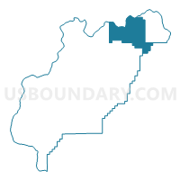
Voting District 306, Douglas County, Washington
About
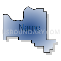
Outline

Summary
| Unique Area Identifier | 684098 |
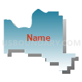
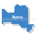
| Name | Voting District 306 |
| County | Douglas County |
| State | Washington |
| Area (square miles) | 135.03 |
| Land Area (square miles) | 132.68 |
| Water Area (square miles) | 2.35 |
| % of Land Area | 98.26 |
| % of Water Area | 1.74 |
| Latitude of the Internal Point | 48.02291170 |
| Longtitude of the Internal Point | -119.30783620 |
Maps


Graphs
Select a template below for downloading or customizing gragh for Voting District 306, Douglas County, Washington


Neighbors
Neighoring Voting District (by Name) Neighboring Voting District on the Map
- Voting District 304, Douglas County, WA
- Voting District 307, Douglas County, WA
- Voting District 308, Douglas County, WA
- Duley Lake Voting District, Okanogan County, WA
- North Banks Lake Voting District, Grant County, WA
- Water: Banks Lake, Grant County, WA
Top 10 Neighboring County Subdivision (by Population) Neighboring County Subdivision on the Map
- Bridgeport CCD, Douglas County, WA (6,499)
- Colville Reservation CCD, Okanogan County, WA (5,954)
- Grand Coulee CCD, Grant County, WA (2,207)
Top 10 Neighboring Unified School District (by Population) Neighboring Unified School District on the Map
- Okanogan School District, WA (5,637)
- Grand Coulee Dam School District, WA (4,236)
- Bridgeport School District, WA (3,252)
Top 10 Neighboring State Legislative District Lower Chamber (by Population) Neighboring State Legislative District Lower Chamber on the Map
Top 10 Neighboring State Legislative District Upper Chamber (by Population) Neighboring State Legislative District Upper Chamber on the Map
Top 10 Neighboring 111th Congressional District (by Population) Neighboring 111th Congressional District on the Map
Top 10 Neighboring Census Tract (by Population) Neighboring Census Tract on the Map
- Census Tract 9501, Douglas County, WA (6,499)
- Census Tract 101, Grant County, WA (3,638)
- Census Tract 9402, Okanogan County, WA (3,129)